With Excel Math curriculum, children learn how to measure with non-standard units as early as Kindergarten. By first and second grade, students learn standard units of measurement. Here's a sample from the Grade 2 Student Lesson Sheets. Problem J takes a look at one of the units we use to measure water:
How much water do you think covers your state? Which state has the highest percentage of water area? (Not coastal water, but inland. Areas such as the Great Lakes are excluded for this calculation.)
Let's visit some bodies of water around the United States. We'll start our trip with a trip to Hawaii. Enjoy the sunset over the ocean in Kailua-Kona on the Big Island. According to the U.S. Geological Survey, Hawaii has a total land area of 6423 square miles. It has a water area of 38 square miles. So Hawaii's total square miles of both land and water is 6461. To find the percentage of the state covered by water, we divide 38 by 6461 to get .0058, which rounds up to 0.6%.
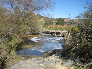
 Now we'll move on to California. In 1774, five years after Mission San Diego de Alcala was built in San Diego, it was moved to Mission Valley to provide a more dependable source of water from the San Diego River. The friars found a place 6 miles up the river to build the 244-foot long, 13-foot thick, 13-foot wide dam. They used Indian labor from the mission to construct the dam from
stone and cement on exposed bedrock, creating a permanent reservoir
behind it. Water was released through gates and spillways into a gravity-fed flume, ending in a basin near the Mission. Here's the Old Mission Dam today:
Heading up the coast, we stop off in Del Mar Heights to visit the beach. The water's not too cold, so we'll grab our boards, wade in...
and then jump into the surf to catch a wave:
The land area of California is 155,959 square miles. The water area is 2,674 square miles. So the total of land and water in square miles is 158,633. In other words .0168 or 1.7% of California is water.
Moving across the country to Iowa, we find that the land area of this state is 55,869 square miles. The water area is 402 square miles. You do the math. (Did you get an answer of .0071?) So .7% of Iowa is water—not quite as high a percentage of water as in California. Here's a photo of the sunset over Lake Okoboji:
And we'll conclude our cross-country tour with a visit to George Washington's home in Mount Vernon. Virginia has a land area of 39,594 square miles and a water area of 1,006 square miles. That gives Virginia a higher percentage of water than California at 2.5%. This is a view of the Potomac River from Mount Vernon:
According to the U.S. Geological Survey, the state with the highest percentage of water is Rhode Island with 17%, and the state with the smallest percentage is New Mexico at just .2%. Here's a recap of what we've learned about the percentage of water that makes up each of these states. To see a chart with all 50 states, visit the U.S. Geological Survey website.


